Juneau Alaska3D Map
Source: Brenton T. White.


Juneau
Contents
Description
Map
Explore
Excursions
History

Alaska3D
Anchorage
Juneau
Ketchikan
Sitka
Skagway

Valdez
Vancouver
Victoria

Alaska
Itinerary
Ports
Wildlife
Culture

References

Juneau Area Alaska3D Map

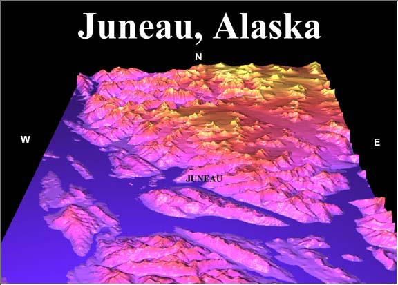
Base Data: U.S. Geological Survey.
Rendered with Dem3D


Street Map | Topographic | Aerial Photo | Alaska3D

Note:  The topographic map and aerial photo are quite large files (~191K and 97K, respectively), but they do provide some very good detail of Juneau and the surrounding area.  Should be worth the download time.

World | Alaska | Far East | Mediterranean | Panama Canal | South America
Cruise on the Web | The Ports | Your Ship | References


© Copyright 1997, 1998 Brenton T. White. Many of the photos and maps are courtesy of Crystal Cruises.
Please e-mail comments about this website to: Webmaster.
Last modified: July 25, 2005.